0
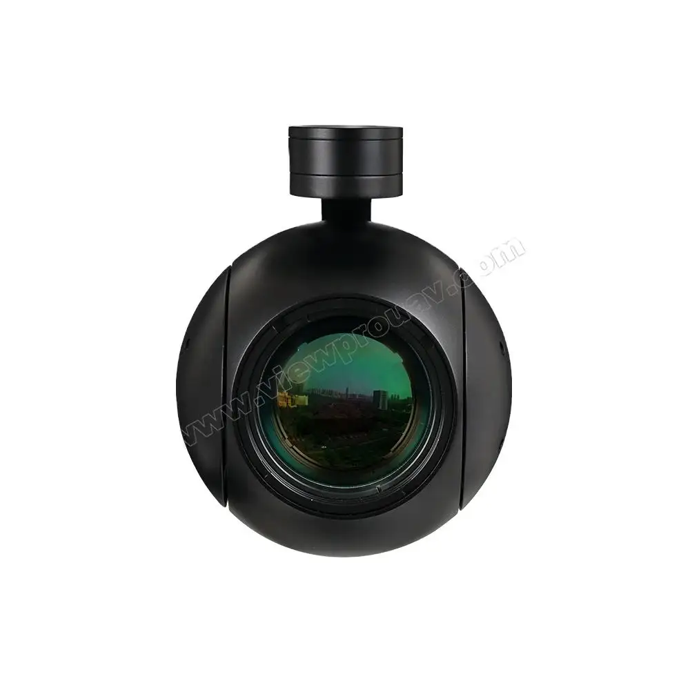
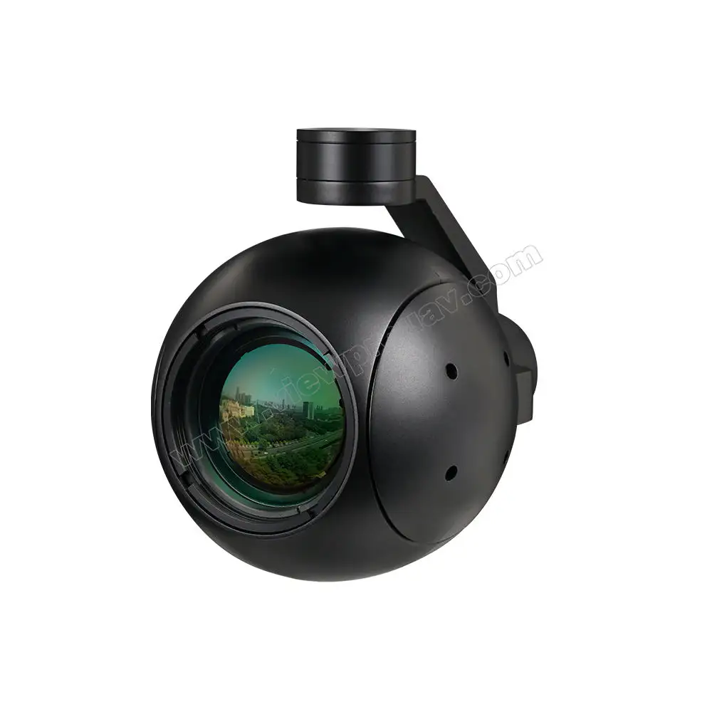
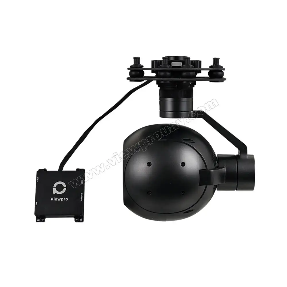
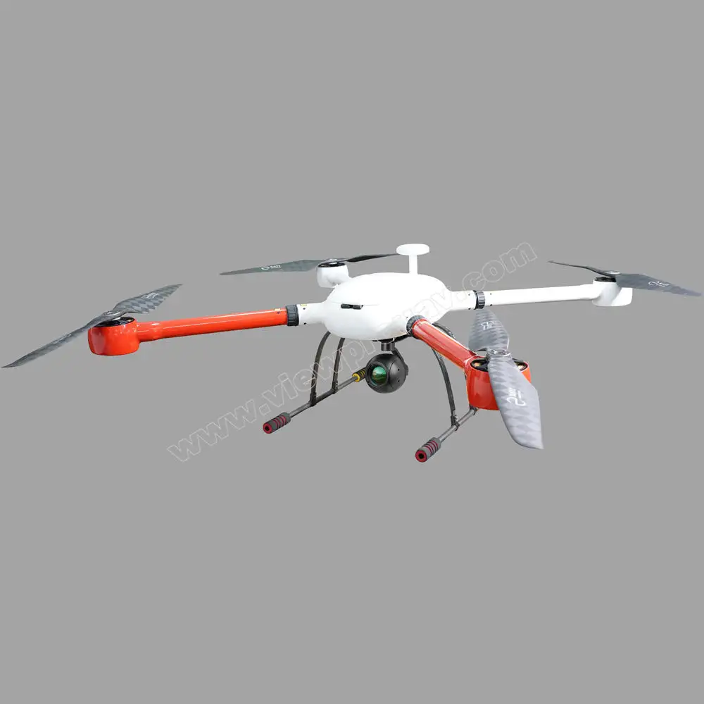
AT50 640*512 IR Laser Rangefinder Thermal Automatic Tracking 3-axis Gimibal Mapping Aerial Photography Ai Camera for UAV
$6,164.00
( All products are support customized, and the price is priced according to the quantity ladder, and customers who like it hurry up to consult me!!!)
A high-performance UAV thermal imaging payload integrating a 640×512 infrared thermal sensor, laser rangefinder, AI object tracking, and a 3-axis gimbal. It is designed for precision aerial surveying, mapping, and inspection across industrial, agricultural, and emergency sectors.
Description
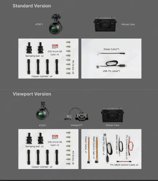
Specifications:
-
Thermal Sensor Resolution: 640 × 512 pixels
-
Lens Type: High-quality infrared thermal lens
-
Laser Rangefinder: Integrated for accurate distance measurement
-
Gimbal: 3-axis stabilized gimbal for smooth imaging and tracking
-
AI Capabilities: Intelligent object detection and auto-tracking
-
Image Enhancement: Super-resolution algorithms and thermal contrast optimization
-
Output Formats: Thermal video and still image capture
-
Data Overlay: Real-time distance and temperature readouts
-
Power Input: DC 12V (compatible with UAV platforms)
-
Weight: Lightweight and UAV-ready
-
Control Interface: Compatible with standard UAV remote systems and ground stations
Key Features:
-
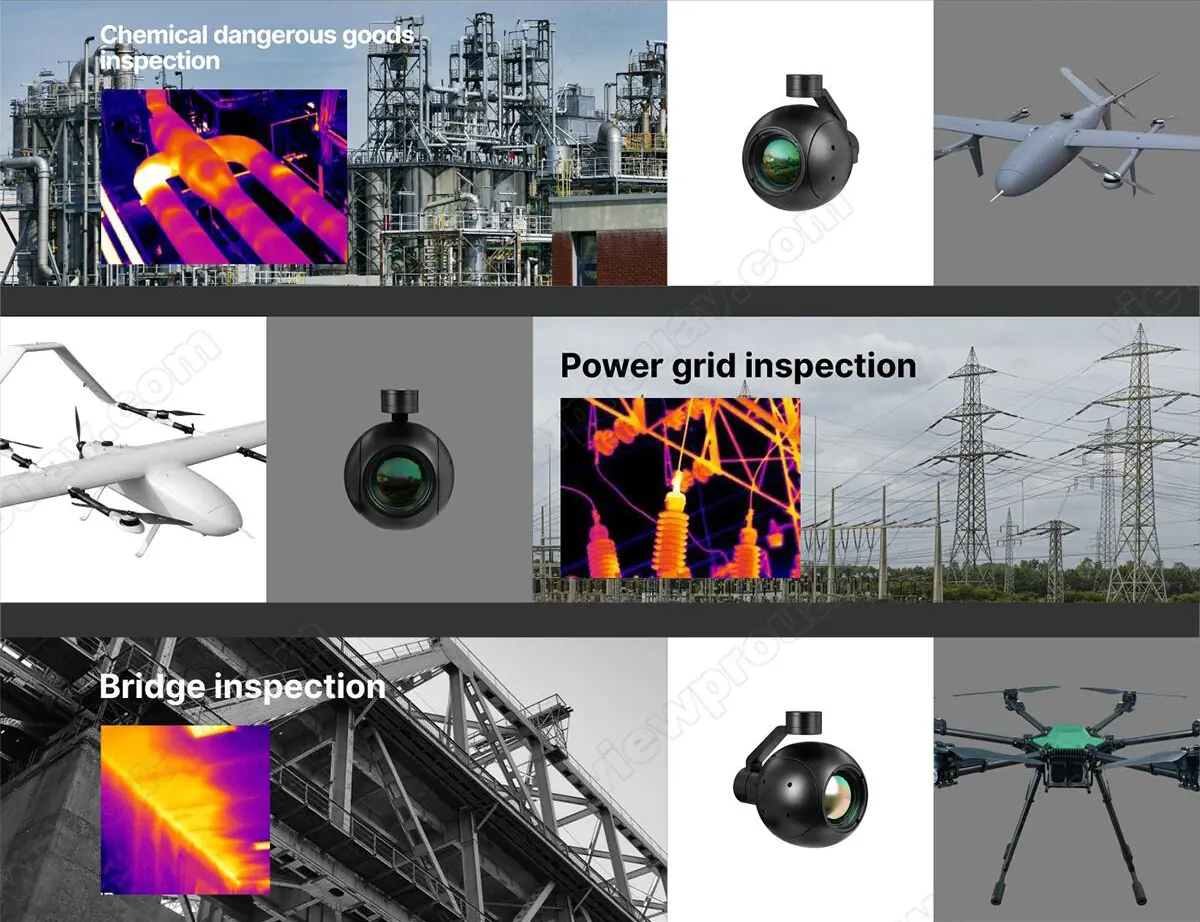
Laser Rangefinder Integration: Measures precise distances to targets, improving mapping and search accuracy
-
Thermal Imaging Clarity: 640×512 resolution enables detailed thermal scans, even in low visibility conditions
-
3-Axis Stabilized Gimbal: Maintains image stability during dynamic flight maneuvers
-
AI Auto-Tracking: Identifies and follows subjects (people, vehicles, animals) in real-time
-
Mapping & Survey-Ready: Delivers georeferenced thermal imagery for mission-critical tasks
-
Multiple Display Modes: Thermal, pseudo-color, and temperature-isolated visuals
-
Versatile Data Output: Supports live transmission and onboard storage options
-
Weather-Resistant Build: Suitable for outdoor use in varying environmental conditions
Related products
-

Caddx Ratel 2 V2 FPV Camera Ratel2 2.1mm Lens 16-9/4-3 NTSC/PAL Switchable With Replacement Lens Micro for FPV Drone RC
$23.50 View Details -

Caddx FPV 1500TVL Ratel Pro Black Light Camera Night Vision Wide Dynamic Camera for FPV Drone Rc
$30.50 View Details -
A40 Pro 40x Optical Zoom AI Identification and Tracking Pod 513W Pixel Camera 360 Continuous for UAV
$3,661.00 View Details -
RunCam Night Eagle 3 V2 1500TVL Ultra Light FOVD NTSC/PAL CMOS FPV Starlight Night Vision Camera for FPV Drone RC
$55.50 View Details

Reviews
There are no reviews yet.